

You are using an out of date browser. It may not display this or other websites correctly.
You should upgrade or use an alternative browser.
You should upgrade or use an alternative browser.
Level Design Omaha beach map project need help!!
- Thread starter lallup
- Start date
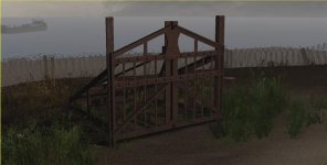
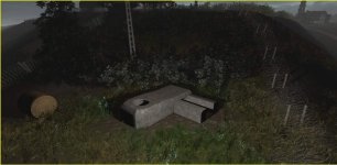
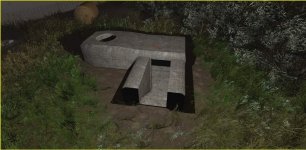
also another view of the tobruk bunker remodelled and properly working underground, plus the other bunker sitting on top of hill reworked 
Attachments
Last edited:
Upvote
0
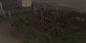
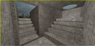
also another view of the tobruk bunker remodelled and properly working underground, plus the other bunker sitting on top of hill reworked
Nice Job Lallup!
Might have steal some of those bunkers!
Last edited:
Upvote
0
Looks promising! Especially the bocage part. Will we see those tall hedges that were giving US forces problems when advancing through Normandy?
The ones they thought were smaller from aerial recon photos and turned out to be taller than expected?
The ones they thought were smaller from aerial recon photos and turned out to be taller than expected?
Upvote
0
Looks promising! Especially the bocage part. Will we see those tall hedges that were giving US forces problems when advancing through Normandy?
The ones they thought were smaller from aerial recon photos and turned out to be taller than expected?
you got it >D
Last edited:
Upvote
0

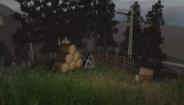
Yeah hedgerows were elevated bits of ground with lots of scrub growing on it.
yup!
Last edited:
Upvote
0
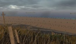
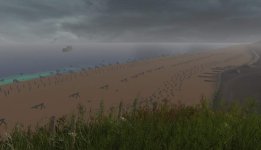
The water looks a bit tropical. The English channel is rather drab even on a Nice day. D-day was a short break between storms. Heavy cloud and the seas were choppy. Wasn't raining though.
Also before the landings there was a naval barrage and large bombing run. The bombs mostly missed, landing in between the start of the german bunkers to 5km behind that. But the quick naval barrage scratched its targets. So maybe there should be a couple of craters in the german defences at the far end of the beach. And many more craters and damage as you go inland as that was all bombed to bits. Even though there was literally no one there other than french civilians. The phone lines had already been cut by french resistance so it didn't even damage them.
Also have you seen Commander shepards LCVPs?
Also what part of the beach is this?
Last edited:
Upvote
0
My only worry about this map is will it set my CPU on fire trying to calculate the awesome degree of EVERYTHING in it.
Upvote
0