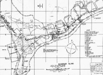
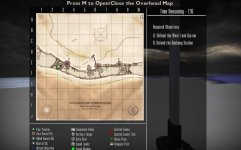
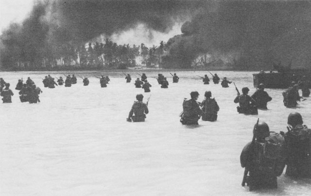
Makin' Makin, October 1943, AKA Butaritari.
Map is only of the Japanese defensive area, a strip of land 100m wide x 800m long. Already laid out 3 pairs of objectives, for a total of 6. Allies will attack from the West (left in overhead map).
First set of objectives is the Western Tank barrier and Onchong Station.
Middle combination, Bunkers and King's Warf.
Final two, Stone pier (where the radio and radar posts are located) and the Eastern Tank Barrier.
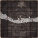
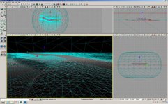
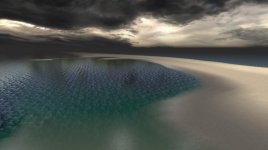
This is just the first few hours progress to collect reference material and establish scale/scope. Now for the fun part
Map is only of the Japanese defensive area, a strip of land 100m wide x 800m long. Already laid out 3 pairs of objectives, for a total of 6. Allies will attack from the West (left in overhead map).
First set of objectives is the Western Tank barrier and Onchong Station.
Middle combination, Bunkers and King's Warf.
Final two, Stone pier (where the radio and radar posts are located) and the Eastern Tank Barrier.
This is just the first few hours progress to collect reference material and establish scale/scope. Now for the fun part